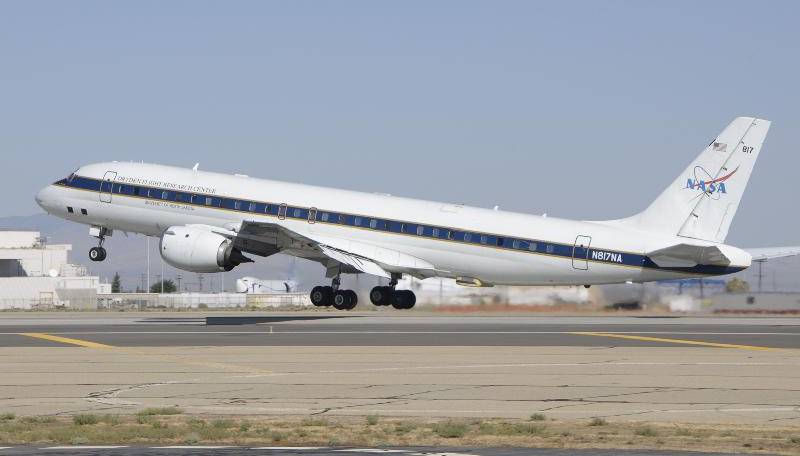
PALMDALE – Beginning Tuesday, NASA will fly an airborne science laboratory above Canadian snowstorms to tackle a difficult challenge facing the upcoming Global Precipitation Measurement (GPM) satellite mission — measuring snowfall from space.
GPM is an international satellite mission that will set a new standard for precipitation measurements from space, providing next-generation observations of worldwide rain and snow every three hours. It is also the first mission designed to detect falling snow from space.
“Snow is notoriously hard to measure as it falls,” said Walter Petersen, the GPM ground validation scientist at NASA’s Wallops Flight Facility in Virginia. “Snowflakes contain varying amounts of air and water, and they flutter, wobble and drift as they leave the clouds.”

Knowing how “wet” a snowflake is allows scientists to measure overall water content. A wet, heavy snow can shut down a city, and melted snow is a crucial source of freshwater in many areas.
Working with Environment Canada, NASA’s GPM Cold-season Precipitation Experiment (GCPEx) will measure light rain and snow in Ontario from Jan. 17 to Feb. 29. The field campaign is designed to improve satellite estimates of falling snow and test ground validation capabilities in advance of the planned launch of the GPM Core satellite in 2014.
NASA’s DC-8 airborne science laboratory will fly out of Bangor, Maine, carrying radar and a radiometer that will simulate the measurements to be taken from space by GPM. At an altitude of 33,000 feet (10 kilometers), the DC-8 will make multiple passes over an extensive ground network of snow gauges and sensors at Environment Canada’s Center for Atmospheric Research Experiments north of Toronto.
The GCPEx field experiment will help scientists match measurements of snow in the air and on the ground with the satellite’s measurements.
“We will be looking at the precipitation and the physics of precipitation, such as snowflake types, sizes, shapes, numbers and water content,” Petersen said. “These properties affect both how we interpret and improve our measurements.”
NASA’s Dryden Flight Research Center in Edwards manages the DC-8 flights for the GCPEx mission. The aircraft is based at the center’s aircraft operations facility in Palmdale.
(Information via press release from NASA Dryden Flight Research Center.)